Jordan River
JR (2015-ongoing)
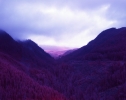
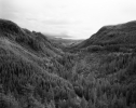
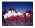
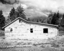
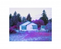
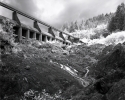
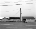
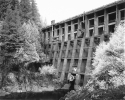
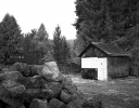
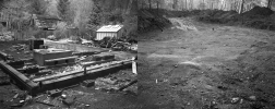
Seventy kilometres from Victoria, the former settlement of Jordan River clings tenaciously to the south west coast of Vancouver Island. The origin site of the Pacheedaht First Nation, and known as Diitiida in their traditional language, the area is situated on one of the major fault line in the Cascadia Subduction zone. This is remarkable considering that the hamlet of Jordan River and its handful of inhabitants were located 12 kilometers downstream from a large reservoir and two aging concrete diversion dams constructed over a century ago. In December 2014, BC Hydro released scientific findings that a large-scale earthquake would result in the collapse of the dam and the complete inundation of the town site within minutes. They claimed a rebuild was too costly and decommissioning the structures was unfeasible as they provide one third of Vancouver Island’s overall generating capacity. By the summer of 2016, all but one resident of the remaining eleven waterfront homes had negotiated buyouts with BC Hydro and agreed to relocate elsewhere. In March 2017, save for the single holdout and his cabin beside the ocean, the town was razed. Currently the Pacheedaht First Nation is in negotiations with the provincial and federal governments and is working on an agreement-in-principle for the return of their lands.
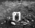
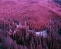
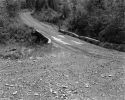
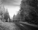
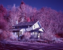
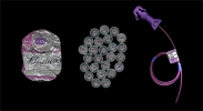
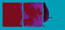
Since 2015, I have engaged in the act of photographically surveying this region and recording its contemporary transition. I am employing traditional film techniques sensitive to the near-infrared section of the light spectrum – a process born by scientific, forensic and medical desires to see beyond the capabilities of human vision, and to reveal hidden details and sub-surface faults. Now largely obsolete, this film (and the images that it renders) has a visual quality that lends itself to the unfamiliar. Similar to the current transformation of the settlement and its surroundings, this project is ongoing.
